


Friday 15 September 2023
| Distance (km) | 28 kms | |||
| Distance (time) | 11.5 hrs | |||
| Climb / Descent | 1300m / 1700m | |||
| Hard / Soft surface | 20% / 80% | |||
| Landscape |
|
|||
| Weather |
|
|||
|
|
||||
|
We have been discussing about this stage for days now, and mostly on what to do. The part from St.Dalmas to Utelle has always been one of the longest
parts without any accomodation or facilities and we were happy to see that in 2019 (when we were still struggling north from the Mont Blanc) that in
the tiny hamlet that is approximately halfway, Les Granges de la Brasque, the municipality had revided an old holiday camp to cabins with the possibility
to also camp. But of course during covid it had to close and this is where things went sour. In 2020 the municipality (Utelle) elected a new major and
apparently this new major was against the transformation of the holiday camp to a tourist accomodation from the beginning, so found an excuse to close it.
First by closing the restaurant because allegedly there had been complaints, and then later when the caretaker of the place addressed that he had
to spent his time there under unfavourable working conditions, the place was closed rather than improved. And so after covid it didn't reopen and
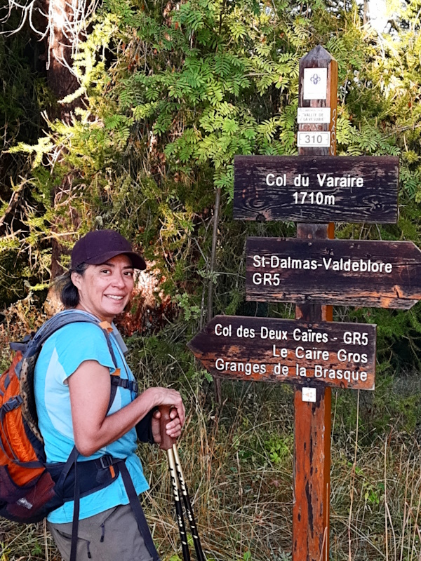
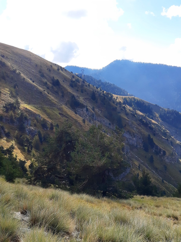
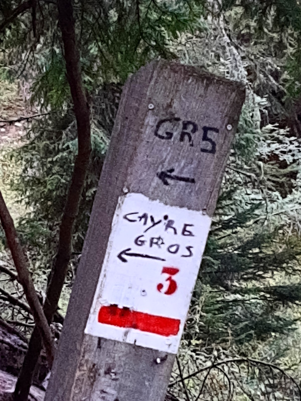
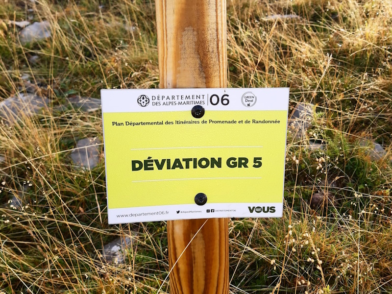
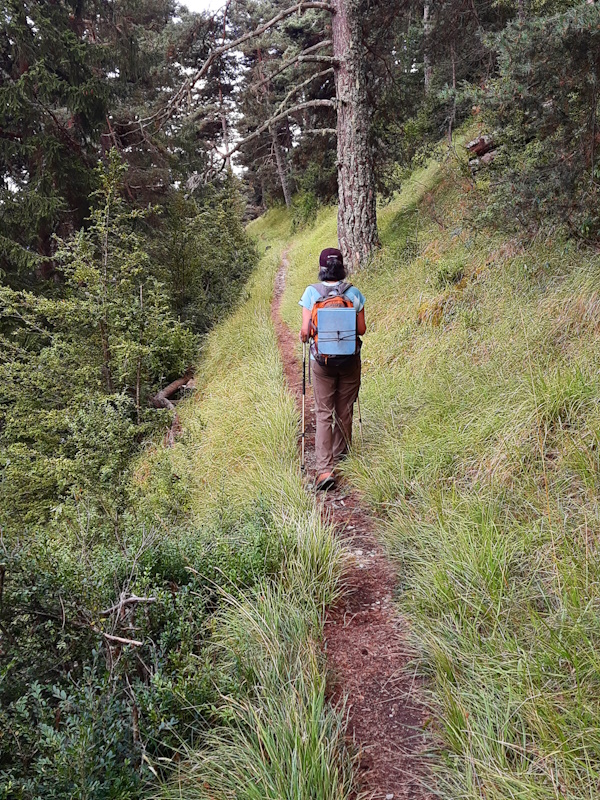
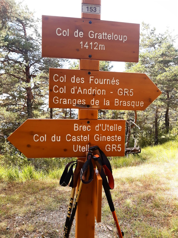
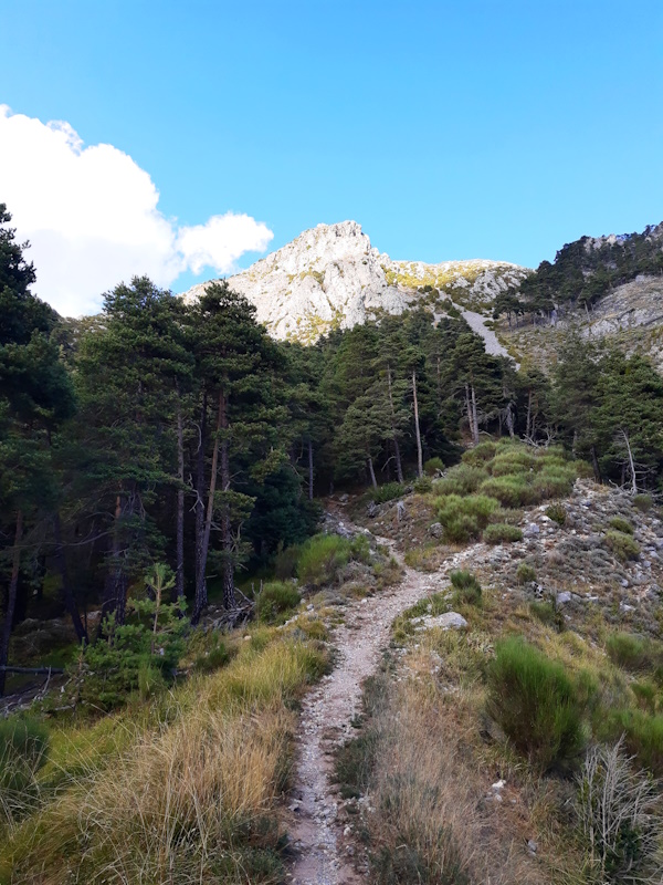
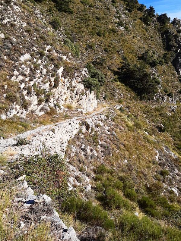
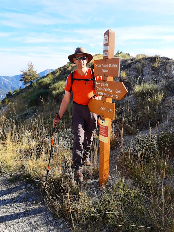
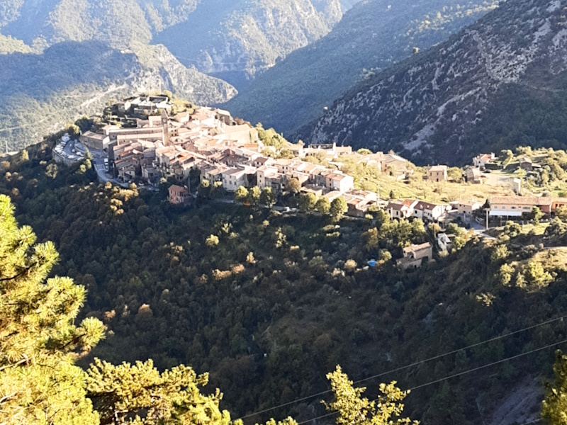
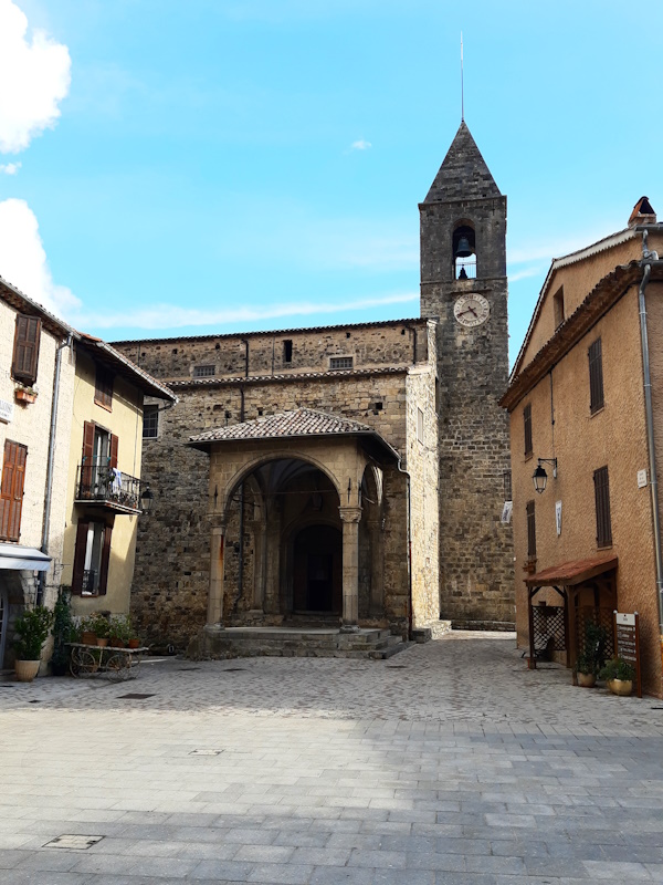
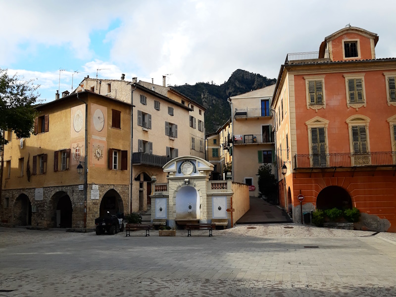
GR5 walkers are again with a long stage without accomodation. Hopefully in the future it will reopen, but that will be too late for us. So what do we do? Carry the tent and make bivouac halfway? It's an option, but Lupita doesn't really like the idea of not having a shower and a toilet, so no. Park a car there (there is a narrow tarmac road) and split it in two? It is an option, but it is a 20 km narrow winding road to get there and we would have to do it several times (place the car, return, place it again the next day, pick it up again) and after our experience on the very narrow road to Pont Rouge it doesn't feel like a good idea either. And then there is option 3: park a car in Utelle and walk the full stage in a single day but with small daypacks only bringing food and water. So this is what we're going to do. And because of the length of it, we keep referring to today's stage as the "monster stage". We will see if it lives up to it's name. Having set up basecamp on the farmer's camping in St.Dalmas-Valdeblore we first had laundry day on Thursday, and that went a little bit wrong. There was a 70% chance of a shower in the afternoon, but in the end it started bucketing at 3pm and we had torrential rain for 3 hours including thunder and lightning. So the laundry didn't dry at all, but our main concern: the hiking trail would be muddy and slippery. Today we got up at 5:30 to start walking at 6:45 when it was still not quite light. But we still have to walk a few minutes along the road to the village and it is getting light fast, so by the time we are off the tarmac it should be light enough to not trip over every stone. Unfortunately out of the village we have to go straight up over a very rocky 4x4 forest track. And the rain of the day before hadn't improved the quality of the track either. It is hard to find any grip on the wet track with stones rolling from underneath your feet. Further up we cross another 4x4 track and going straight ahead is now a walking trail with most of the time easier gradients up Col Varaire. The pass is in the forest with zero views, but this is not the highest point yet: after a short flatter part we continue to climb to Col des Deux Caires. Especially the last bit going up with a few hairpins are quite an effort. Well, at least we have a nice view here and we should be pretty much at the highest point as the GR5 rolls a bit up and down from here around 1950m altitude. Well, no, this is where it gets complicated. At the col a sign tells us that the GR5 trail is closed due to a "major slide" and an cross country. So we go left and up, very steep again, until the path kind of splits. To the left is clearly the most used, but it has again a sign that it is closed and even forbidden and on top of that there is a cross marking to indicate it is not a GR. The sign nicely adds "GR5: use the alternative route". Eh...I thought this WAS the alternative route. But apparently we missed something earlier. I don't like going back but straight ahead we can see the slide. It isn't too big, but if it is unstable then trying to cross it is madness. The only way to pass a slide is to pass above it, so let's follow the closed and forbidden track to see if it brings us high enough to do so. And in fact the track does go up zigzagging without getting close to the slide. We may not be on the GR5 at the moment, but we can see the track that is the old closed GR5 and we know where to go so we are not too worried. Just under the summit of the Caïre Gros we a narrow path spliits of to the right and since that is geographically the correct direction we decide to take it. There are wooden poles along this track at regular distances, and on the 3rd or 4th wooden pole we pass there is a small sign "Deviation GR5". Ok, we're good now. Thinking about it ... didn't we mention a couple of days ago we were not going to be above 2000m anymore? Well, the GPS tells us we're at 2068m here, and if we would have followed the correct path over the Caïre Gros we would have reached 2086m. Oops...so the descent from de Stèle Valette is no longer the last point above 2000m. The deviation is narrow and not frequently used and thus very irregular, which my ankles don't really appreciate. But after flattish part and a zigzagging descent it does bring us back to the original GR5 trail. From here it goes rolling up and down along Mont Chalancha a nameless pass indicated as Le Pertus on the map, underneath the peak La Partissuollo to the next little pass Baisse de la Combe. From here it is pretty flat and we can walk fast and easy towards Collet des Trous. That is indeed the case for a while until the path splits. To the right goes direct to Col d'Andrion, but we have to go left to Collet des Trous and that is a bloody steep path to a ridge, and then rolling up and down to Collet des Trous. A bit unexpected effort. At Collet des Trous our suffering is over, from here we have a nice gently descending path until we reach an old military (gravel) road. The GR5 again shortcuts several hairpins, but the shortcuts are heavily eroded and washed out, probably due to the rains of the last days. So we decide to stick with the military road rather than risking our ankles or knees. And so we reach Les Granges de la Brasque where there is tarmac again. We pass Les Granges and admire the now closed touris cabines and contiue for the next 2 kms over a flat tarmac road. On a picnic bench we have something to eat when a elderly lady passes with a basket hanging from her arm. Being in the forest, old lady, basket, we have a Snow-white moment - but fortunately she doesn't offer us an apple. From here we have a long sometimes difficult descent through the forest. Twice we cross the tarmac road that makes a little loop and we decided to follow the hairpin of the tarmac road at almost no extra time. But the last part down there is no alternative and we have to carefully descend to Col des Fournès. Here we encounter an elderly man that is completely on his own reading a newspaper on a picknickbench in the forest. I don't know about here, but we encounter strange people. From here it is a long almost flat part to Col de Gratteloup. Flat, but over a very thin little trail with the valley of the Vésubie river deep down on our left. After the Col de Gratteloup it remains flat until the signpost at the crossing with the GR510 and then it slowly starts climbing towards the Brec d'Utelle. It gets steeper and then it starts zigzagging up to what looks like a col above us. That doesn't look too bad, but when we get there slightly out of breath we find out the climb has hardly started yet. We know have to climb over rocks and it seems impossible there is a path going up here. It feels like being a fly glued to a wall and I should definitely not look down here. But after some rock climbing here and there we pass a little nodge in the Brec d'Utelle called "Breche du Brec" and it is said that this is the first point on the GR5 where it is possible to see the Mediterranean. Well....not today. It is way too humid: we can see in the far distance the flat valley of the river Var, but it kind of dissapears in a white blur that hides the Mediterranean. Too bad, it would have been nice. From here it's a 2 hours descent to Utelle and the descent is pretty good. The first part is steep and winding, but not slippery and with little loose stones. It is more like going down rocky stairs. We arrive at a nameless pass between the Brec d'Utelle and the Tête d'Escandolier. From here we suddenly stay almost flat until signpost 438 from where a side trail goes to La Tour. From here to the Col du Castel Gineste is really beautiful: the path is narrow and against the rock face with great views over the valleys and Madonne d'Utelle. But of course it doesn't bring us much lower so at some point we have to descend more. And indeed, after Col du Castel Gineste the path starts descending more steeply. It is not really difficult, just rocky, but after a long day it is tiring. Several times when we go around a corner we can see Utelle, but it is still an hour walking before we really have to feeling we are close by. Finally, at 18:15, we reach the tarmac at the edge of Utelle and we walk through the village back to our car. We were afraid it was going to be hard to make it in the amount of hours of daylight that we have now in September, but in reality we had 1.5 - 2 hours to spare. We walked fast in times, faster than we would like to really be able to enjoy and look around rather than watching your feet and where to put them all the time. But we did it, though we still have to drive 1.5 hours back to the camping. |
              |
|||
|
|
||||
Download track StDUte.gpx